 vesseltracker.com
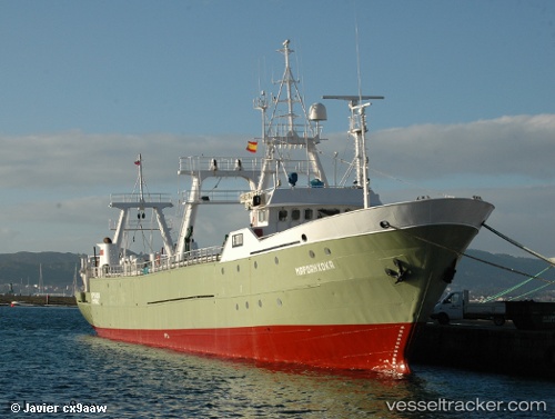
Tatekulu Andimba
Current StatusWhere is the vessel?
Tatekulu Andimba is currently in 46 nm SW of Luderitz Bay, based on AIS data received less than 1h ago.
Latest AIS update:
Current position: 27.02024° S, 14.41047° E (46 nm SW of Luderitz Bay)
Average speed (last 7 days): Loading…
Average speed (last 30 days): Loading…
Vessel profile: Tatekulu Andimba is a Fishing Vessel with dimensions 10m x 70m.
This page combines live AIS, route history, probable destination signals, nearby traffic, and port activity for practical vessel monitoring.
The current position of vessel Tatekulu Andimba is -27.02024 lat / 14.41047 lng. Updated: 2026-05-16 15:12:06 UTCNearest reference points:
- Near Luderitz Bay
Details:
Live Vessel Tatekulu Andimba Analytics (details, animations, etc.)
Recent AIS points (UTC):
2026-05-16 11:29:18 UTC · -27.21326, 14.51862 · SOG 3.5 kn · COG 336°2026-05-16 13:52:46 UTC · -27.08441, 14.46073 · SOG 3.6 kn · COG 321°
2026-05-16 13:52:46 UTC · -27.08441, 14.46073 · SOG 3.6 kn · COG 321°
2026-05-16 15:12:06 UTC · -27.02024, 14.41047 · SOG 3.5 kn · COG 338°