 vesseltracker.com
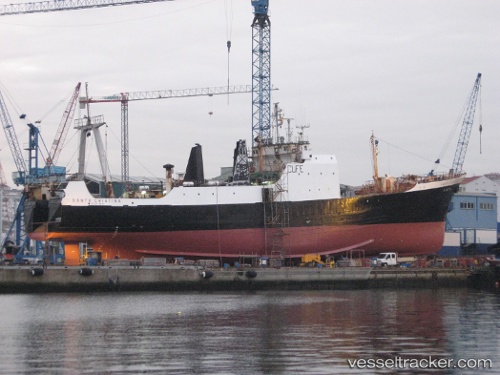
Santa Cristina
Current StatusWhere is the vessel?
Santa Cristina is currently in 66 nm E of Gijon, based on AIS data received about 3h ago.
Latest AIS update:
Current position: 43.70525° N, 49.16460° W (66 nm E of Gijon)
Average speed (last 7 days): Loading…
Average speed (last 30 days): Loading…
Vessel profile: Santa Cristina is a General Cargo Ship with dimensions 12m x 83m.
This page combines live AIS, route history, probable destination signals, nearby traffic, and port activity for practical vessel monitoring.
The current position of vessel Santa Cristina is 43.70525 lat / -49.16460 lng. Updated: 2026-05-16 13:32:30 UTCDetails:
Live Vessel Santa Cristina Analytics (details, animations, etc.)
Recent AIS points (UTC):
2026-05-16 13:32:30 UTC · 43.70525, -49.16460 · SOG 3.8 kn · COG 160°2026-05-16 13:32:30 UTC · 43.70525, -49.16460 · SOG 3.8 kn · COG 160°
2026-05-16 13:32:30 UTC · 43.70525, -49.16460 · SOG 3.8 kn · COG 160°
2026-05-16 13:32:30 UTC · 43.70525, -49.16460 · SOG 3.8 kn · COG 160°