 vesseltracker.com
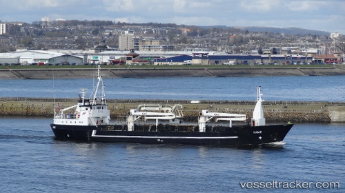
 OMOEFE
Current Status
Where is the vessel?
OMOEFE is currently in 34 nm E of Tomtbod, based on AIS data received about 1h ago.
Latest AIS update:
Current position: 57.02868° N, 19.54887° E (34 nm E of Tomtbod)
Average speed (last 7 days): Loading…
Average speed (last 30 days): Loading…
Vessel profile: OMOEFE is a General Cargo Ship with dimensions 6m x 48m.
This page combines live AIS, route history, probable destination signals, nearby traffic, and port activity for practical vessel monitoring.
The current position of vessel OMOEFE is 57.02868 lat / 19.54887 lng. Updated: 2026-05-14 22:37:22 UTCNearest reference points:
- 39 nm W of Pilies juru uosto PVP/Klaipeda
- Near Cimdenieki
- 37 nm W of Vikati Sadam
Currently sailing under the flag of Cameroon ![]()
OMOEFE built in 1966 year
Deadweight:
788 tDetails:
Live Vessel OMOEFE Analytics (details, animations, etc.)
Recent AIS points (UTC):
2026-05-14 19:44:42 UTC · 56.66240, 19.18518 · SOG 8.8 kn · COG 29°2026-05-14 20:04:31 UTC · 56.70427, 19.22858 · SOG 8.7 kn · COG 29°
2026-05-14 21:56:33 UTC · 56.94335, 19.46150 · SOG 8.6 kn · COG 28°
2026-05-14 22:37:22 UTC · 57.02868, 19.54887 · SOG 8.6 kn · COG 28°