 vesseltracker.com
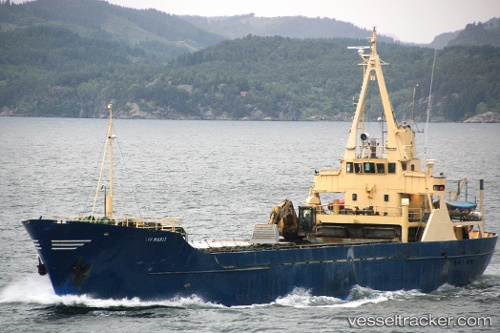
 Liv Marit
Current Status
Where is the vessel?
Liv Marit is currently in Near Eidslandet, based on AIS data received about 1h ago.
Latest AIS update:
Current position: 60.66262° N, 5.74983° E (Near Eidslandet)
Average speed (last 7 days): Loading…
Average speed (last 30 days): Loading…
Vessel profile: Liv Marit is a Multi Purpose Carrier with dimensions 57m x 10m.
This page combines live AIS, route history, probable destination signals, nearby traffic, and port activity for practical vessel monitoring.
The current position of vessel Liv Marit is 60.66262 lat / 5.74983 lng. Updated: 2026-04-28 21:30:59 UTCNearest reference points:
- Near Valestrandsfossen
- Near Damsgård
- Near Bergen
Currently sailing under the flag of Norway ![]()
Liv Marit built in 1966 year
Deadweight:
813 tDetails:
Live Vessel Liv Marit Analytics (details, animations, etc.)
Recent AIS points (UTC):
2026-04-28 12:30:43 UTC · 60.66262, 5.74988 · SOG 0 kn · COG 52°2026-04-28 17:30:52 UTC · 60.66270, 5.74980 · SOG 0 kn · COG 52°
2026-04-28 17:30:52 UTC · 60.66270, 5.74980 · SOG 0 kn · COG 52°
2026-04-28 21:30:59 UTC · 60.66262, 5.74983 · SOG 0 kn · COG 52°