 vesseltracker.com
 ALTAY
ALTAY
Current Status
Where is the vessel?
ALTAY is currently in Near Tamatave, based on AIS data received less than 1h ago.
Latest AIS update:
Current position: 18.15556° S, 49.42443° E (Near Tamatave)
Average speed (last 7 days): Loading…
Average speed (last 30 days): Loading…
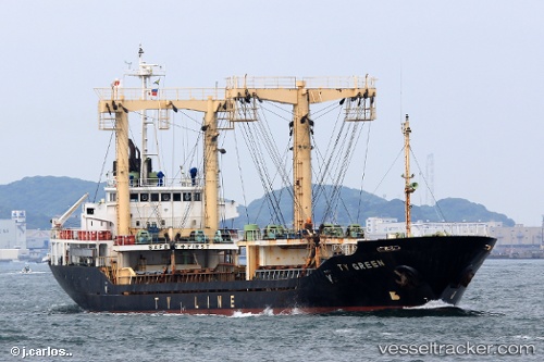
Vessel profile: ALTAY is a General Cargo Ship with dimensions 92m x 14m.
This page combines live AIS, route history, probable destination signals, nearby traffic, and port activity for practical vessel monitoring.
The current position of vessel ALTAY is -18.15556 lat / 49.42443 lng. Updated: 2026-04-28 11:52:05 UTCCurrently sailing under the flag of Sierra leone ![]()
ALTAY built in 1997 year
Deadweight:
3803 tDetails:
Live Vessel ALTAY Analytics (details, animations, etc.)
Recent AIS points (UTC):
2026-04-28 08:10:03 UTC · -18.15549, 49.42449 · SOG 0 kn · COG 168°2026-04-28 09:52:04 UTC · -18.15551, 49.42443 · SOG 0 kn · COG 168°
2026-04-28 11:01:05 UTC · -18.15552, 49.42442 · SOG 0 kn · COG 168°
2026-04-28 11:52:05 UTC · -18.15556, 49.42443 · SOG 0 kn · COG 168°