 vesseltracker.com
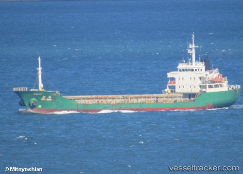
 SILVER WAY
Current Status
Where is the vessel?
SILVER WAY is currently in Near Ol'ga, based on AIS data received about 7d ago.
Latest AIS update:
Current position: 43.71851° N, 135.45436° E (Near Ol'ga)
Average speed (last 7 days): Loading…
Average speed (last 30 days): Loading…
Vessel profile: SILVER WAY is a General Cargo Ship with dimensions 10m x 93m.
This page combines live AIS, route history, probable destination signals, nearby traffic, and port activity for practical vessel monitoring.
The current position of vessel SILVER WAY is 43.71851 lat / 135.45436 lng. Updated: 2026-04-18 05:41:31 UTCNearest reference points:
- 30 nm S of Ol'ga
- 33 nm NE of Ol'ga
- 37 nm SW of PLASTUN
Currently sailing under the flag of Sierra leone ![]()
SILVER WAY built in 1991 year
Deadweight:
3501 tDetails:
Live Vessel SILVER WAY Analytics (details, animations, etc.)
Recent AIS points (UTC):
2026-04-18 03:49:32 UTC · 43.48621, 135.19440 · SOG 10 kn · COG 47°2026-04-18 05:34:31 UTC · 43.70453, 135.43622 · SOG 9.7 kn · COG 39°
2026-04-18 05:41:31 UTC · 43.71851, 135.45436 · SOG 9.8 kn · COG 37°
2026-04-18 05:41:31 UTC · 43.71851, 135.45436 · SOG 9.8 kn · COG 37°