 vesseltracker.com
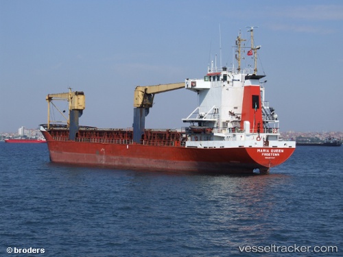
Maria Queen
Current StatusWhere is the vessel?
Maria Queen is currently in Near EL DEKHEILA, based on AIS data received about 6h ago.
Latest AIS update:
Current position: 31.19180° N, 29.72325° E (Near EL DEKHEILA)
Average speed (last 7 days): Loading…
Average speed (last 30 days): Loading…
Vessel profile: Maria Queen is a General Cargo Ship with dimensions 14m x 92m.
This page combines live AIS, route history, probable destination signals, nearby traffic, and port activity for practical vessel monitoring.
The current position of vessel Maria Queen is 31.19180 lat / 29.72325 lng. Updated: 2026-04-10 07:08:10 UTCNearest reference points:
- Near EL DEKHEILA
- Near Alexandria
- 13 nm W of EL DEKHEILA
Details:
Live Vessel Maria Queen Analytics (details, animations, etc.)
Recent AIS points (UTC):
2026-04-10 02:11:01 UTC · 31.19152, 29.72314 · SOG 0 kn · COG -1°2026-04-10 03:56:04 UTC · 31.19169, 29.72317 · SOG 0.5 kn · COG -1°
2026-04-10 05:32:07 UTC · 31.19167, 29.72314 · SOG 0.5 kn · COG -1°
2026-04-10 07:08:10 UTC · 31.19180, 29.72325 · SOG 0.8 kn · COG -1°