 vesseltracker.com
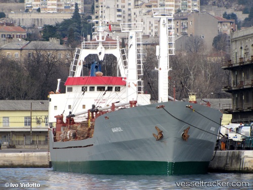
 HALA STAR
Current Status
Where is the vessel?
HALA STAR is currently in 11 nm SW of Kassos, based on AIS data received less than 1h ago.
Latest AIS update:
Current position: 35.28214° N, 26.76188° E (11 nm SW of Kassos)
Average speed (last 7 days): Loading…
Average speed (last 30 days): Loading…
Vessel profile: HALA STAR is a General Cargo Ship with dimensions 89m x 14m.
This page combines live AIS, route history, probable destination signals, nearby traffic, and port activity for practical vessel monitoring.
The current position of vessel HALA STAR is 35.28214 lat / 26.76188 lng. Updated: 2026-04-20 13:16:23 UTCNearest reference points:
- 20 nm S of Astypálaia
- 13 nm E of Nisiros
- 12 nm E of GYALI
Currently sailing under the flag of Togo ![]()
HALA STAR built in 1983 year
Deadweight:
4231 tDetails:
Live Vessel HALA STAR Analytics (details, animations, etc.)
Recent AIS points (UTC):
2026-04-20 09:18:33 UTC · 35.02578, 26.25499 · SOG 7 kn · COG -1°2026-04-20 09:18:33 UTC · 35.02578, 26.25499 · SOG 7 kn · COG -1°
2026-04-20 12:13:14 UTC · 35.23483, 26.59723 · SOG 7.4 kn · COG -1°
2026-04-20 13:16:23 UTC · 35.28214, 26.76188 · SOG 8.4 kn · COG -1°