 vesseltracker.com
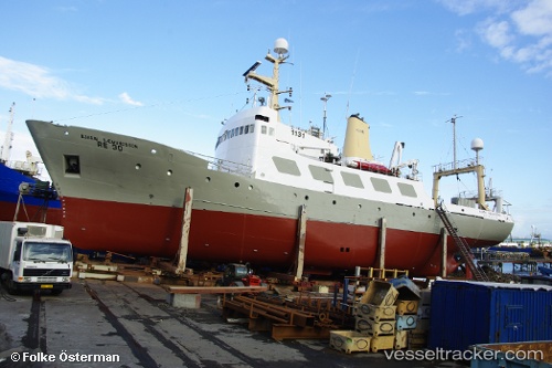
 BJARNI SAEMUNDSSON
Current Status
Where is the vessel?
BJARNI SAEMUNDSSON is currently in 27 nm W of Jarjis, based on AIS data received about 1h ago.
Latest AIS update:
Current position: 33.57500° N, 11.63500° W (27 nm W of Jarjis)
Average speed (last 7 days): Loading…
Average speed (last 30 days): Loading…
Vessel profile: BJARNI SAEMUNDSSON is a Fishery Research Vessel with dimensions m x m.
This page combines live AIS, route history, probable destination signals, nearby traffic, and port activity for practical vessel monitoring.
The current position of vessel BJARNI SAEMUNDSSON is 33.57500 lat / -11.63500 lng. Updated: 2026-05-14 19:46:26 UTCNearest reference points:
- 25 nm SW of Jarjis
- 44 nm SW of Jarjis
- 34 nm N of Jarjis
Currently sailing under the flag of Togo ![]()
Details:
Live Vessel BJARNI SAEMUNDSSON Analytics (details, animations, etc.)
Recent AIS points (UTC):
2026-05-14 16:31:27 UTC · 34.09333, -11.38167 · SOG 10 kn · COG -1°2026-05-14 18:07:26 UTC · 33.83167, -11.47833 · SOG 2 kn · COG -1°
2026-05-14 18:58:29 UTC · 33.70333, -11.55500 · SOG 10 kn · COG -1°
2026-05-14 19:46:26 UTC · 33.57500, -11.63500 · SOG 11 kn · COG -1°