 vesseltracker.com
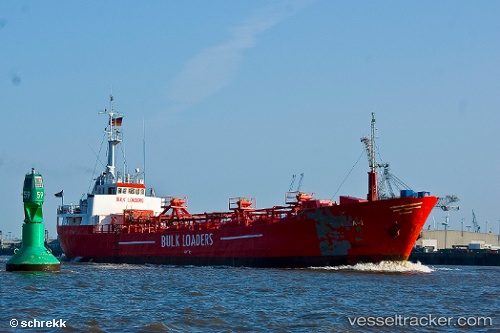
 Lola 1
Current Status
Where is the vessel?
Lola 1 is currently in 39 nm NW of Terschelling, based on AIS data received less than 1h ago.
Latest AIS update:
Current position: 54.00500° N, 4.91833° E (39 nm NW of Terschelling)
Average speed (last 7 days): Loading…
Average speed (last 30 days): Loading…
Vessel profile: Lola 1 is a Cement Carrier with dimensions 55m x 9m.
This page combines live AIS, route history, probable destination signals, nearby traffic, and port activity for practical vessel monitoring.
The current position of vessel Lola 1 is 54.00500 lat / 4.91833 lng. Updated: 2026-05-14 09:56:26 UTCNearest reference points:
- Near Molengat
- Near de Waal
- Near OUDESCHILD
Currently sailing under the flag of St Vincent Grenadines ![]()
Lola 1 built in 1967 year
Deadweight:
838 tDetails:
Live Vessel Lola 1 Analytics (details, animations, etc.)
Recent AIS points (UTC):
2026-05-14 05:43:59 UTC · 54.64496, 5.08460 · SOG 9 kn · COG 193°2026-05-14 07:53:25 UTC · 54.31833, 5.01333 · SOG 9 kn · COG -1°
2026-05-14 08:11:25 UTC · 54.27167, 5.00333 · SOG 9 kn · COG -1°
2026-05-14 09:56:26 UTC · 54.00500, 4.91833 · SOG 9 kn · COG -1°