 vesseltracker.com
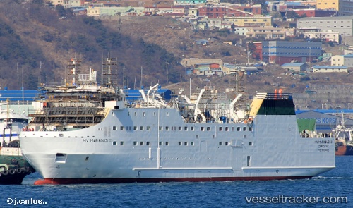
Mapinduzi Ii
Current StatusWhere is the vessel?
Mapinduzi Ii is currently in Near Zanzibar, based on AIS data received about 9d ago.
Latest AIS update:
Current position: 6.15688° S, 39.18108° E (Near Zanzibar)
Average speed (last 7 days): Loading…
Average speed (last 30 days): Loading…
Vessel profile: Mapinduzi Ii is a Passenger General Cargo Ship with dimensions 17m x 90m.
This page combines live AIS, route history, probable destination signals, nearby traffic, and port activity for practical vessel monitoring.
The current position of vessel Mapinduzi Ii is -6.15688 lat / 39.18108 lng. Updated: 2026-05-07 11:39:16 UTCNearest reference points:
- Near Dar Es Salaam
- 11 nm SE of Mombasa
- Near Mombasa
Details:
Live Vessel Mapinduzi Ii Analytics (details, animations, etc.)
Recent AIS points (UTC):
2026-05-07 11:39:16 UTC · -6.15688, 39.18108 · SOG 0.1 kn · COG 26°2026-05-07 11:39:16 UTC · -6.15688, 39.18108 · SOG 0.1 kn · COG 26°
2026-05-07 11:39:16 UTC · -6.15688, 39.18108 · SOG 0.1 kn · COG 26°
2026-05-07 11:39:16 UTC · -6.15688, 39.18108 · SOG 0.1 kn · COG 26°