 vesseltracker.com
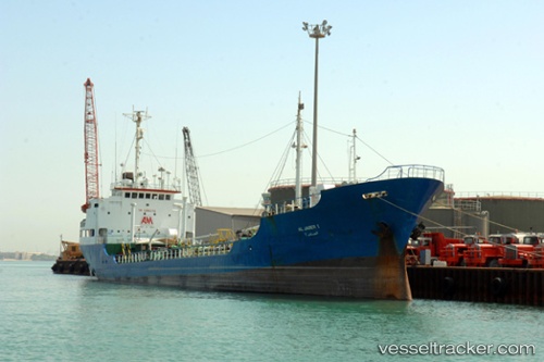
Shamim
Current StatusWhere is the vessel?
Shamim is currently in Near Mombasa, based on AIS data received less than 1h ago.
Latest AIS update:
Current position: 4.07407° S, 39.65715° E (Near Mombasa)
Average speed (last 7 days): Loading…
Average speed (last 30 days): Loading…
Vessel profile: Shamim is a Oil Products Tanker with dimensions 12m x 72m.
This page combines live AIS, route history, probable destination signals, nearby traffic, and port activity for practical vessel monitoring.
The current position of vessel Shamim is -4.07407 lat / 39.65715 lng. Updated: 2026-05-14 12:16:17 UTCNearest reference points:
- Near Mombasa
- 11 nm SE of Mombasa
Details:
Live Vessel Shamim Analytics (details, animations, etc.)
Recent AIS points (UTC):
2026-05-14 07:25:27 UTC · -4.05863, 39.61175 · SOG 0 kn · COG -1°2026-05-14 09:35:07 UTC · -4.05601, 39.64426 · SOG 4.4 kn · COG -1°
2026-05-14 10:06:58 UTC · -4.08122, 39.67103 · SOG 4 kn · COG -1°
2026-05-14 12:16:17 UTC · -4.07407, 39.65715 · SOG 5.7 kn · COG -1°