 vesseltracker.com
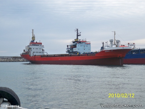
 Mohamed 1
Current Status
Where is the vessel?
Mohamed 1 is currently in 42 nm SE of Bulgarevo, based on AIS data received about 2d ago.
Latest AIS update:
Current position: 42.75188° N, 28.79265° E (42 nm SE of Bulgarevo)
Average speed (last 7 days): Loading…
Average speed (last 30 days): Loading…
Vessel profile: Mohamed 1 is a General Cargo Ship with dimensions 84m x 14m.
This page combines live AIS, route history, probable destination signals, nearby traffic, and port activity for practical vessel monitoring.
The current position of vessel Mohamed 1 is 42.75188 lat / 28.79265 lng. Updated: 2026-04-10 02:14:15 UTCNearest reference points:
- 20 nm SE of Varna
- 54 nm SE of Sveti Nikola
- Near Shabla
Currently sailing under the flag of Tanzania ![]()
Mohamed 1 built in 1981 year
Deadweight:
3054 tDetails:
Live Vessel Mohamed 1 Analytics (details, animations, etc.)
Recent AIS points (UTC):
2026-04-10 02:13:54 UTC · 42.75282, 28.79273 · SOG 9.6 kn · COG 178°2026-04-10 02:14:15 UTC · 42.75188, 28.79265 · SOG 9.6 kn · COG 179°
2026-04-10 02:14:15 UTC · 42.75188, 28.79265 · SOG 9.6 kn · COG 179°
2026-04-10 02:14:15 UTC · 42.75188, 28.79265 · SOG 9.6 kn · COG 179°