 vesseltracker.com
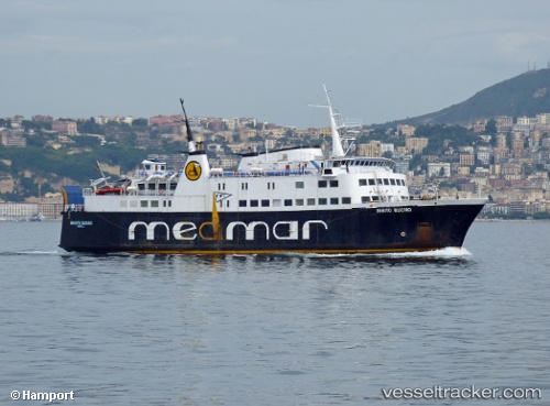
 Benito Buono
Current Status
Where is the vessel?
Benito Buono is currently in Near ISCHIA, based on AIS data received about 6h ago.
Latest AIS update:
Current position: 40.74534° N, 13.93958° E (Near ISCHIA)
Average speed (last 7 days): Loading…
Average speed (last 30 days): Loading…
Vessel profile: Benito Buono is a Passenger Ro Ro Cargo Ship with dimensions 74m x 16m.
This page combines live AIS, route history, probable destination signals, nearby traffic, and port activity for practical vessel monitoring.
The current position of vessel Benito Buono is 40.74534 lat / 13.93958 lng. Updated: 2026-05-14 15:48:39 UTCNearest reference points:
- Near MERGELLINA
- Near Naples
- Near Anacapri
Currently sailing under the flag of Italy ![]()
Benito Buono built in 1968 year
Deadweight:
610 tDetails:
Live Vessel Benito Buono Analytics (details, animations, etc.)
Recent AIS points (UTC):
2026-05-14 15:48:39 UTC · 40.74534, 13.93958 · SOG 0 kn · COG -1°2026-05-14 15:48:39 UTC · 40.74534, 13.93958 · SOG 0 kn · COG -1°
2026-05-14 15:48:39 UTC · 40.74534, 13.93958 · SOG 0 kn · COG -1°
2026-05-14 15:48:39 UTC · 40.74534, 13.93958 · SOG 0 kn · COG -1°