 vesseltracker.com
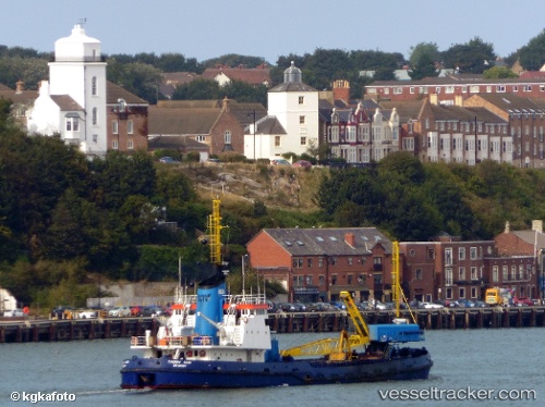
 Cherry Sand
Current Status
Where is the vessel?
Cherry Sand is currently in Near Avonmouth, based on AIS data received about 1h ago.
Latest AIS update:
Current position: 51.50515° N, 2.70480° W (Near Avonmouth)
Average speed (last 7 days): Loading…
Average speed (last 30 days): Loading…
Vessel profile: Cherry Sand is a Hopper Dredger with dimensions 62m x 12m.
This page combines live AIS, route history, probable destination signals, nearby traffic, and port activity for practical vessel monitoring.
The current position of vessel Cherry Sand is 51.50515 lat / -2.70480 lng. Updated: 2026-04-28 00:08:43 UTCNearest reference points:
- Near Avonmouth
- Near PORTBURY
- Near Bird Port
Currently sailing under the flag of United Kingdom ![]()
Cherry Sand built in 1968 year
Deadweight:
2305 tDetails:
Live Vessel Cherry Sand Analytics (details, animations, etc.)
Recent AIS points (UTC):
2026-04-27 19:55:33 UTC · 51.50495, -2.70523 · SOG 0.1 kn · COG 31°2026-04-27 22:09:24 UTC · 51.50515, -2.70483 · SOG 0 kn · COG 27°
2026-04-27 22:57:24 UTC · 51.50513, -2.70482 · SOG 0 kn · COG 27°
2026-04-28 00:08:43 UTC · 51.50515, -2.70480 · SOG 0 kn · COG 27°