 vesseltracker.com
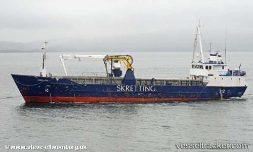
Magan D
Current StatusWhere is the vessel?
Magan D is currently in 34 nm NW of Unst, based on AIS data received about 1h ago.
Latest AIS update:
Current position: 61.23749° N, 1.49811° W (34 nm NW of Unst)
Average speed (last 7 days): Loading…
Average speed (last 30 days): Loading…
Vessel profile: Magan D is a Fishing Vessel with dimensions 8m x 33m.
This page combines live AIS, route history, probable destination signals, nearby traffic, and port activity for practical vessel monitoring.
The current position of vessel Magan D is 61.23749 lat / -1.49811 lng. Updated: 2026-05-16 15:41:55 UTCNearest reference points:
- 32 nm NW of Eshaness
- 36 nm NW of Ham Voe, Foula
- Near Tingwall
Details:
Live Vessel Magan D Analytics (details, animations, etc.)
Recent AIS points (UTC):
2026-05-16 12:10:27 UTC · 61.28021, -1.47796 · SOG 1.6 kn · COG 174°2026-05-16 13:11:56 UTC · 61.27255, -1.49201 · SOG 0.6 kn · COG 281°
2026-05-16 13:27:56 UTC · 61.27154, -1.49428 · SOG 0.5 kn · COG 277°
2026-05-16 15:41:55 UTC · 61.23749, -1.49811 · SOG 2 kn · COG 201°