 vesseltracker.com
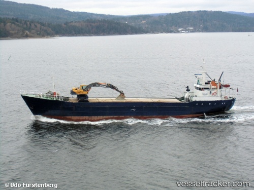
 Torvaag
Current Status
Where is the vessel?
Torvaag is currently in Near Brønnøysund, based on AIS data received about 1h ago.
Latest AIS update:
Current position: 65.42973° N, 12.15283° E (Near Brønnøysund)
Average speed (last 7 days): Loading…
Average speed (last 30 days): Loading…
Vessel profile: Torvaag is a General Cargo Ship with dimensions 49m x 48m.
This page combines live AIS, route history, probable destination signals, nearby traffic, and port activity for practical vessel monitoring.
The current position of vessel Torvaag is 65.42973 lat / 12.15283 lng. Updated: 2026-04-20 00:18:58 UTCNearest reference points:
- Near Brønnøysund
- Near BRONNOYSUND
- Near STRAUMOYVALEN
Currently sailing under the flag of Norway ![]()
Torvaag built in 1968 year
Deadweight:
673 tDetails:
Live Vessel Torvaag Analytics (details, animations, etc.)
Recent AIS points (UTC):
2026-04-19 19:51:09 UTC · 64.85906, 11.25342 · SOG 9.7 kn · COG 68°2026-04-19 21:40:18 UTC · 65.05476, 11.73343 · SOG 9.5 kn · COG 31°
2026-04-19 22:27:49 UTC · 65.16958, 11.84582 · SOG 9.3 kn · COG 14°
2026-04-20 00:18:58 UTC · 65.42973, 12.15283 · SOG 9.2 kn · COG 15°