 vesseltracker.com
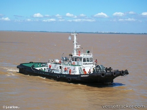
Madrugador
Current StatusWhere is the vessel?
Madrugador is currently in Near Ingeniero White/Bahia Blanca, based on AIS data received about 1h ago.
Latest AIS update:
Current position: 38.78182° S, 62.30235° W (Near Ingeniero White/Bahia Blanca)
Average speed (last 7 days): Loading…
Average speed (last 30 days): Loading…
Vessel profile: Madrugador is a Tug with dimensions 10m x 34m.
This page combines live AIS, route history, probable destination signals, nearby traffic, and port activity for practical vessel monitoring.
The current position of vessel Madrugador is -38.78182 lat / -62.30235 lng. Updated: 2026-05-14 11:53:39 UTCDetails:
Live Vessel Madrugador Analytics (details, animations, etc.)
Recent AIS points (UTC):
2026-05-14 07:42:50 UTC · -38.78183, -62.30233 · SOG 0 kn · COG -1°2026-05-14 09:44:40 UTC · -38.78179, -62.30232 · SOG 0 kn · COG -1°
2026-05-14 11:14:51 UTC · -38.78182, -62.30233 · SOG 0 kn · COG -1°
2026-05-14 11:53:39 UTC · -38.78182, -62.30235 · SOG 0 kn · COG -1°