 vesseltracker.com
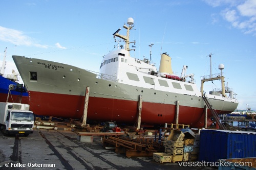
 BJARNI SAEMUNDSSON
Current Status
Where is the vessel?
BJARNI SAEMUNDSSON is currently in 69 nm N of Caleta de Sebo, based on AIS data received about 1h ago.
Latest AIS update:
Current position: 30.36891° N, 13.64310° W (69 nm N of Caleta de Sebo)
Average speed (last 7 days): Loading…
Average speed (last 30 days): Loading…
Vessel profile: BJARNI SAEMUNDSSON is a Fishery Research Vessel with dimensions m x m.
This page combines live AIS, route history, probable destination signals, nearby traffic, and port activity for practical vessel monitoring.
The current position of vessel BJARNI SAEMUNDSSON is 30.36891 lat / -13.64310 lng. Updated: 2026-05-15 17:32:01 UTCNearest reference points:
- 58 nm N of Caleta de Sebo
- 83 nm N of Caleta de Sebo
- 56 nm NW of Caleta de Sebo
Currently sailing under the flag of Togo ![]()
Details:
Live Vessel BJARNI SAEMUNDSSON Analytics (details, animations, etc.)
Recent AIS points (UTC):
2026-05-15 13:48:14 UTC · 30.92922, -13.24551 · SOG 10.3 kn · COG 213°2026-05-15 15:58:30 UTC · 30.59167, -13.48500 · SOG 10 kn · COG -1°
2026-05-15 16:37:29 UTC · 30.50167, -13.54667 · SOG 10 kn · COG -1°
2026-05-15 17:32:01 UTC · 30.36891, -13.64310 · SOG 10.7 kn · COG 206°