 vesseltracker.com
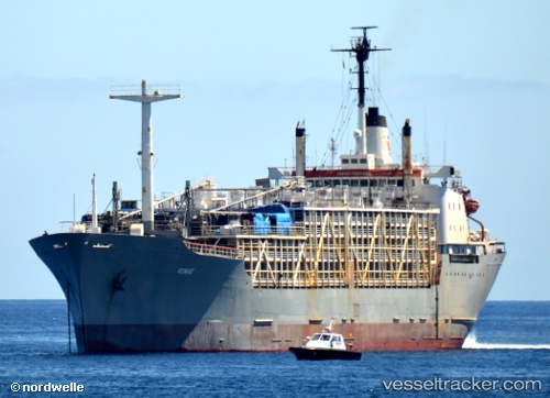
 Kenoz
Kenoz
Current Status
Where is the vessel?
Kenoz is currently in Near Tuzla Free Zone, based on AIS data received about 337d ago.
Latest AIS update:
Current position: 40.83035° N, 29.30793° E (Near Tuzla Free Zone)
Average speed (last 7 days): Loading…
Average speed (last 30 days): Loading…
Vessel profile: Kenoz is a Livestock Carrier with dimensions 183m x 20m.
This page combines live AIS, route history, probable destination signals, nearby traffic, and port activity for practical vessel monitoring.
The current position of vessel Kenoz is 40.83035 lat / 29.30793 lng. Updated: 2025-06-12 13:40:44 UTCNearest reference points:
- Near Tuzla Free Zone
- Near TUZLA
- Near PENDIK
Currently sailing under the flag of Panama ![]()
Kenoz built in 1970 year
Deadweight:
10453 tDetails:
Live Vessel Kenoz Analytics (details, animations, etc.)
Recent AIS points (UTC):
2025-06-12 13:40:44 UTC · 40.83035, 29.30793 · SOG 0 kn · COG 30°