 vesseltracker.com
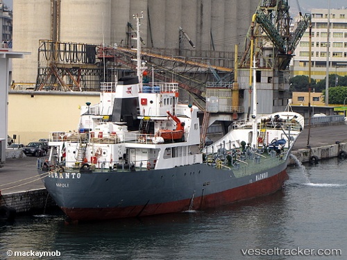
Jeranto
Current StatusWhere is the vessel?
Jeranto is currently in Near Naples, based on AIS data received about 1h ago.
Latest AIS update:
Current position: 40.84020° N, 14.27582° E (Near Naples)
Average speed (last 7 days): Loading…
Average speed (last 30 days): Loading…
Vessel profile: Jeranto is a Water Tanker with dimensions 12m x 80m.
This page combines live AIS, route history, probable destination signals, nearby traffic, and port activity for practical vessel monitoring.
The current position of vessel Jeranto is 40.84020 lat / 14.27582 lng. Updated: 2026-05-14 11:36:04 UTCNearest reference points:
- Near Naples
- Near MERGELLINA
- Near Castellammare di Stabia
Details:
Live Vessel Jeranto Analytics (details, animations, etc.)
Recent AIS points (UTC):
2026-05-14 08:24:14 UTC · 40.84021, 14.27580 · SOG 0 kn · COG -1°2026-05-14 10:12:09 UTC · 40.84020, 14.27582 · SOG 0 kn · COG -1°
2026-05-14 10:39:09 UTC · 40.84021, 14.27582 · SOG 0 kn · COG -1°
2026-05-14 11:36:04 UTC · 40.84020, 14.27582 · SOG 0 kn · COG -1°