 vesseltracker.com
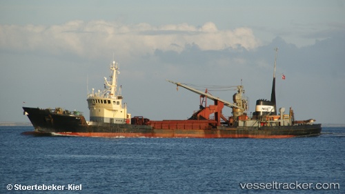
 Glarea
Current Status
Where is the vessel?
Glarea is currently in Near Esbjerg, based on AIS data received less than 1h ago.
Latest AIS update:
Current position: 55.44688° N, 8.47895° E (Near Esbjerg)
Average speed (last 7 days): Loading…
Average speed (last 30 days): Loading…
Vessel profile: Glarea is a Dredger with dimensions 82m x 82m.
This page combines live AIS, route history, probable destination signals, nearby traffic, and port activity for practical vessel monitoring.
The current position of vessel Glarea is 55.44688 lat / 8.47895 lng. Updated: 2026-05-14 21:59:58 UTCNearest reference points:
- Near Esbjerg
- Near Fanoe
- Near Blavand
Currently sailing under the flag of Denmark ![]()
Glarea built in 1971 year
Deadweight:
2266 tDetails:
Live Vessel Glarea Analytics (details, animations, etc.)
Recent AIS points (UTC):
2026-05-14 17:25:59 UTC · 55.44114, 8.26798 · SOG 11.2 kn · COG 49°2026-05-14 19:44:58 UTC · 55.44688, 8.47895 · SOG 0 kn · COG 245°
2026-05-14 20:02:58 UTC · 55.44691, 8.47896 · SOG 0 kn · COG 245°
2026-05-14 21:59:58 UTC · 55.44688, 8.47895 · SOG 0 kn · COG 244°