 vesseltracker.com
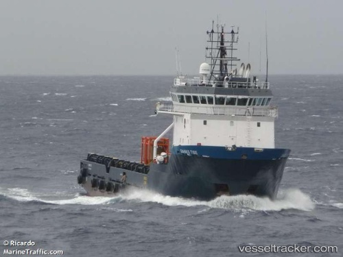
Danko Tide
Current StatusWhere is the vessel?
Danko Tide is currently in Near NITEROI, based on AIS data received about 1h ago.
Latest AIS update:
Current position: 22.82500° S, 43.09167° W (Near NITEROI)
Average speed (last 7 days): Loading…
Average speed (last 30 days): Loading…
Vessel profile: Danko Tide is a Offshore Tug Supply Ship with dimensions 16m x 70m.
This page combines live AIS, route history, probable destination signals, nearby traffic, and port activity for practical vessel monitoring.
The current position of vessel Danko Tide is -22.82500 lat / -43.09167 lng. Updated: 2026-05-14 10:18:26 UTCNearest reference points:
- Near NITEROI
- Near Rio De Janeiro
- Near Santos Dumont Apt/Rio de Janeiro
Details:
Live Vessel Danko Tide Analytics (details, animations, etc.)
Recent AIS points (UTC):
2026-05-14 07:06:21 UTC · -22.82560, -43.09222 · SOG 0 kn · COG 162°2026-05-14 07:42:19 UTC · -22.82559, -43.09223 · SOG 0 kn · COG 162°
2026-05-14 10:12:26 UTC · -22.82500, -43.09167 · SOG 0 kn · COG -1°
2026-05-14 10:18:26 UTC · -22.82500, -43.09167 · SOG 0 kn · COG -1°