 vesseltracker.com
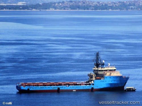
Maersk Ventura
Current StatusWhere is the vessel?
Maersk Ventura is currently in 15 nm W of Fluminense FPSO, based on AIS data received about 2h ago.
Latest AIS update:
Current position: 22.70143° S, 40.67919° W (15 nm W of Fluminense FPSO)
Average speed (last 7 days): Loading…
Average speed (last 30 days): Loading…
Vessel profile: Maersk Ventura is a Offshore Tug Supply Ship with dimensions 18m x 89m.
This page combines live AIS, route history, probable destination signals, nearby traffic, and port activity for practical vessel monitoring.
The current position of vessel Maersk Ventura is -22.70143 lat / -40.67919 lng. Updated: 2026-04-24 15:58:46 UTCNearest reference points:
- Near Fluminense FPSO
- 24 nm SE of Carapebus
- 47 nm E of Arraial do Cabo
Details:
Live Vessel Maersk Ventura Analytics (details, animations, etc.)
Recent AIS points (UTC):
2026-04-24 13:51:44 UTC · -22.67024, -40.54556 · SOG 0 kn · COG 39°2026-04-24 14:02:17 UTC · -22.66833, -40.56500 · SOG 9 kn · COG -1°
2026-04-24 15:52:39 UTC · -22.70189, -40.68056 · SOG 0.9 kn · COG 248°
2026-04-24 15:58:46 UTC · -22.70143, -40.67919 · SOG 0.8 kn · COG 248°