 vesseltracker.com
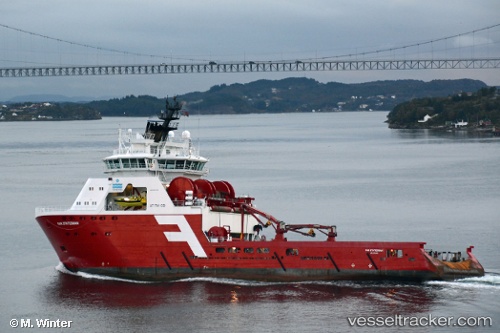
 NORMAND STATESMAN
Current Status
Where is the vessel?
NORMAND STATESMAN is currently in 57 nm S of Santos Dumont Apt/Rio de Janeiro, based on AIS data received about 913d ago.
Latest AIS update:
Current position: 23.84752° S, 43.00056° W (57 nm S of Santos Dumont Apt/Rio de Janeiro)
Average speed (last 7 days): Loading…
Average speed (last 30 days): Loading…
Vessel profile: NORMAND STATESMAN is a Offshore Tug/Supply Ship with dimensions 87m x 21m.
This page combines live AIS, route history, probable destination signals, nearby traffic, and port activity for practical vessel monitoring.
The current position of vessel NORMAND STATESMAN is -23.84752 lat / -43.00056 lng. Updated: 2023-11-13 02:16:22 UTCNearest reference points:
- 27 nm SW of Santos Dumont Apt/Rio de Janeiro
- 49 nm S of SEPETIBA
- Near Santos Dumont Apt/Rio de Janeiro
Currently sailing under the flag of Brazil ![]()
NORMAND STATESMAN built in 2013 year
Deadweight:
4015 tDetails:
Live Vessel NORMAND STATESMAN Analytics (details, animations, etc.)
Recent AIS points (UTC):
2023-11-13 02:16:22 UTC · -23.84752, -43.00056 · SOG 4.1 kn · COG 357°