 vesseltracker.com
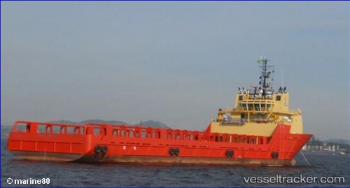
Bram Belem
Current StatusWhere is the vessel?
Bram Belem is currently in Near NITEROI, based on AIS data received less than 1h ago.
Latest AIS update:
Current position: 22.83417° S, 43.14242° W (Near NITEROI)
Average speed (last 7 days): Loading…
Average speed (last 30 days): Loading…
Vessel profile: Bram Belem is a Offshore Tug Supply Ship with dimensions 18m x 84m.
This page combines live AIS, route history, probable destination signals, nearby traffic, and port activity for practical vessel monitoring.
The current position of vessel Bram Belem is -22.83417 lat / -43.14242 lng. Updated: 2026-04-24 11:48:53 UTCNearest reference points:
- Near NITEROI
- Near Rio De Janeiro
- Near Santos Dumont Apt/Rio de Janeiro
Details:
Live Vessel Bram Belem Analytics (details, animations, etc.)
Recent AIS points (UTC):
2026-04-24 08:15:13 UTC · -22.83367, -43.14234 · SOG 0 kn · COG 146°2026-04-24 10:18:21 UTC · -22.83417, -43.14238 · SOG 0 kn · COG 359°
2026-04-24 10:45:25 UTC · -22.83414, -43.14253 · SOG 0 kn · COG 29°
2026-04-24 11:48:53 UTC · -22.83417, -43.14242 · SOG 0 kn · COG 19°