 vesseltracker.com
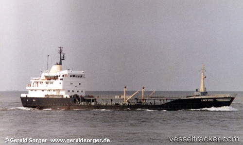
 SOPHIA
Current Status
Where is the vessel?
SOPHIA is currently in Near SHINAS, based on AIS data received about 22h ago.
Latest AIS update:
Current position: 24.75918° N, 56.54293° E (Near SHINAS)
Average speed (last 7 days): Loading…
Average speed (last 30 days): Loading…
Vessel profile: SOPHIA is a Oil Products Tanker with dimensions 86m x 12m.
This page combines live AIS, route history, probable destination signals, nearby traffic, and port activity for practical vessel monitoring.
The current position of vessel SOPHIA is 24.75918 lat / 56.54293 lng. Updated: 2026-05-13 09:51:10 UTCNearest reference points:
- 18 nm SE of SHINAS
- 17 nm SE of Shinas
- Near Fujairah
Currently sailing under the flag of Comoros ![]()
SOPHIA built in 1971 year
Deadweight:
3184 tDetails:
Live Vessel SOPHIA Analytics (details, animations, etc.)
Recent AIS points (UTC):
2026-05-13 09:51:10 UTC · 24.75918, 56.54293 · SOG 0.6 kn · COG 277°2026-05-13 09:51:10 UTC · 24.75918, 56.54293 · SOG 0.6 kn · COG 277°
2026-05-13 09:51:10 UTC · 24.75918, 56.54293 · SOG 0.6 kn · COG 277°
2026-05-13 09:51:10 UTC · 24.75918, 56.54293 · SOG 0.6 kn · COG 277°