 vesseltracker.com
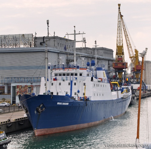
 Mare Nigrum
Current Status
Where is the vessel?
Mare Nigrum is currently in Near Constanta, based on AIS data received less than 1h ago.
Latest AIS update:
Current position: 44.14774° N, 28.66731° E (Near Constanta)
Average speed (last 7 days): Loading…
Average speed (last 30 days): Loading…
Vessel profile: Mare Nigrum is a Fishing Vessel with dimensions 78m x 14m.
This page combines live AIS, route history, probable destination signals, nearby traffic, and port activity for practical vessel monitoring.
The current position of vessel Mare Nigrum is 44.14774 lat / 28.66731 lng. Updated: 2026-05-13 19:15:01 UTCNearest reference points:
- Near Constanta
- Near MIDIA
- Near Ovidiu
Currently sailing under the flag of Romania ![]()
Mare Nigrum built in 1971 year
Deadweight:
1138 tDetails:
Live Vessel Mare Nigrum Analytics (details, animations, etc.)
Recent AIS points (UTC):
2026-05-13 16:24:01 UTC · 44.14773, 28.66729 · SOG 0 kn · COG -1°2026-05-13 17:09:01 UTC · 44.14774, 28.66730 · SOG 0 kn · COG -1°
2026-05-13 18:18:00 UTC · 44.14775, 28.66730 · SOG 0 kn · COG -1°
2026-05-13 19:15:01 UTC · 44.14774, 28.66731 · SOG 0 kn · COG -1°