 vesseltracker.com
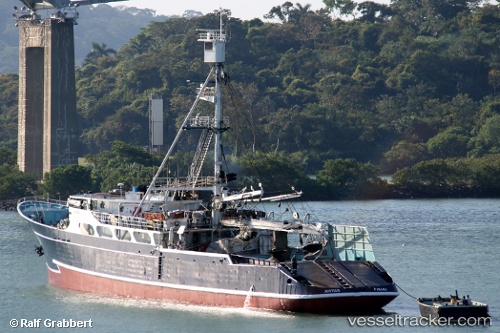
 SEA TUNA I
Current Status
Where is the vessel?
SEA TUNA I is currently in Near Las Margaritas, based on AIS data received less than 1h ago.
Latest AIS update:
Current position: 9.12553° N, 79.06497° W (Near Las Margaritas)
Average speed (last 7 days): Loading…
Average speed (last 30 days): Loading…
Vessel profile: SEA TUNA I is a Fishing Vessel with dimensions 12m x 64m.
This page combines live AIS, route history, probable destination signals, nearby traffic, and port activity for practical vessel monitoring.
The current position of vessel SEA TUNA I is 9.12553 lat / -79.06497 lng. Updated: 2026-05-15 07:20:04 UTCNearest reference points:
- Near El Chorrillo
- Near Panama
- Near Cocoli
Currently sailing under the flag of Panama ![]()
SEA TUNA I built in 1971 year
Deadweight:
0 tDetails:
Live Vessel SEA TUNA I Analytics (details, animations, etc.)
Recent AIS points (UTC):
2026-05-15 03:53:33 UTC · 9.12500, -79.06333 · SOG 0 kn · COG -1°2026-05-15 04:02:28 UTC · 9.12500, -79.06500 · SOG 0 kn · COG -1°
2026-05-15 05:41:31 UTC · 9.12500, -79.06500 · SOG 0 kn · COG -1°
2026-05-15 07:20:04 UTC · 9.12553, -79.06497 · SOG 0 kn · COG -1°