 vesseltracker.com
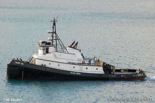
 Nola Gail
Current Status
Where is the vessel?
Nola Gail is currently in Near Boeing Field Apt, based on AIS data received less than 1h ago.
Latest AIS update:
Current position: 47.54384° N, 122.33621° W (Near Boeing Field Apt)
Average speed (last 7 days): Loading…
Average speed (last 30 days): Loading…
Vessel profile: Nola Gail is a Tug with dimensions 32m x 10m.
This page combines live AIS, route history, probable destination signals, nearby traffic, and port activity for practical vessel monitoring.
The current position of vessel Nola Gail is 47.54384 lat / -122.33621 lng. Updated: 2026-05-15 11:56:45 UTCNearest reference points:
- Near Interbay
- Near Boeing Field Apt
- Near Madison Park
Currently sailing under the flag of USA ![]()
Nola Gail built in 1971 year
Details:
Live Vessel Nola Gail Analytics (details, animations, etc.)
Recent AIS points (UTC):
2026-05-15 07:59:05 UTC · 47.54386, -122.33622 · SOG 0 kn · COG 349°2026-05-15 10:08:15 UTC · 47.54384, -122.33624 · SOG 0 kn · COG 350°
2026-05-15 10:14:25 UTC · 47.54382, -122.33621 · SOG 0 kn · COG 350°
2026-05-15 11:56:45 UTC · 47.54384, -122.33621 · SOG 0 kn · COG 350°