 vesseltracker.com
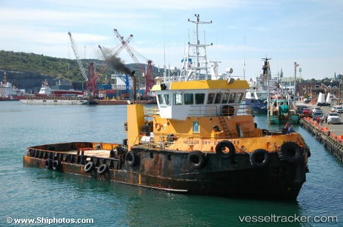
Hudson Bay Explorer
Current StatusWhere is the vessel?
Hudson Bay Explorer is currently in Near GRAND MANAN, based on AIS data received about 114d ago.
Latest AIS update:
Current position: 44.73667° N, 66.69500° W (Near GRAND MANAN)
Average speed (last 7 days): Loading…
Average speed (last 30 days): Loading…
Vessel profile: Hudson Bay Explorer is a Offshore Tug Supply Ship with dimensions 10m x 34m.
This page combines live AIS, route history, probable destination signals, nearby traffic, and port activity for practical vessel monitoring.
The current position of vessel Hudson Bay Explorer is 44.73667 lat / -66.69500 lng. Updated: 2026-01-21 10:20:34 UTCNearest reference points:
- 16 nm W of Tiverton
- Near Tiverton
- Near St. John
Details:
Live Vessel Hudson Bay Explorer Analytics (details, animations, etc.)
Recent AIS points (UTC):
2026-01-21 10:20:34 UTC · 44.73667, -66.69500 · SOG 9 kn · COG -1°