 vesseltracker.com
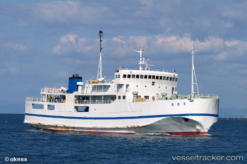
 Star Belitung
Current Status
Where is the vessel?
Star Belitung is currently in Near PANGKAL BALAM, based on AIS data received about 3d ago.
Latest AIS update:
Current position: 2.09327° S, 106.12814° E (Near PANGKAL BALAM)
Average speed (last 7 days): Loading…
Average speed (last 30 days): Loading…
Vessel profile: Star Belitung is a Passenger Ro Ro Cargo Ship with dimensions 72m x 12m.
This page combines live AIS, route history, probable destination signals, nearby traffic, and port activity for practical vessel monitoring.
The current position of vessel Star Belitung is -2.09327 lat / 106.12814 lng. Updated: 2026-05-11 00:24:58 UTCNearest reference points:
- Near PANGKAL BALAM
- 38 nm SW of PANGKAL BALAM
- 46 nm NW of Tanjung Pandan
Currently sailing under the flag of Indonesia ![]()
Details:
Live Vessel Star Belitung Analytics (details, animations, etc.)
Recent AIS points (UTC):
2026-05-11 00:24:58 UTC · -2.09327, 106.12814 · SOG 0 kn · COG -1°2026-05-11 00:24:58 UTC · -2.09327, 106.12814 · SOG 0 kn · COG -1°
2026-05-11 00:24:58 UTC · -2.09327, 106.12814 · SOG 0 kn · COG -1°
2026-05-11 00:24:58 UTC · -2.09327, 106.12814 · SOG 0 kn · COG -1°