 vesseltracker.com
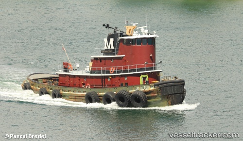
 JOHN TURECAMO
Current Status
Where is the vessel?
JOHN TURECAMO is currently in Near Pensacola, based on AIS data received about 15h ago.
Latest AIS update:
Current position: 30.40350° N, 87.21217° W (Near Pensacola)
Average speed (last 7 days): Loading…
Average speed (last 30 days): Loading…
Vessel profile: JOHN TURECAMO is a Tug with dimensions 9m x 34m.
This page combines live AIS, route history, probable destination signals, nearby traffic, and port activity for practical vessel monitoring.
The current position of vessel JOHN TURECAMO is 30.40350 lat / -87.21217 lng. Updated: 2026-05-13 16:12:25 UTCNearest reference points:
- Near Lillian
- Near Orange Beach
- Near Bon Secour
Currently sailing under the flag of United States of America ![]()
JOHN TURECAMO built in 1972 year
Deadweight:
0 tDetails:
Live Vessel JOHN TURECAMO Analytics (details, animations, etc.)
Recent AIS points (UTC):
2026-05-13 16:12:25 UTC · 30.40350, -87.21217 · SOG 0 kn · COG 296°2026-05-13 16:12:25 UTC · 30.40350, -87.21217 · SOG 0 kn · COG 296°
2026-05-13 16:12:25 UTC · 30.40350, -87.21217 · SOG 0 kn · COG 296°
2026-05-13 16:12:25 UTC · 30.40350, -87.21217 · SOG 0 kn · COG 296°