 vesseltracker.com
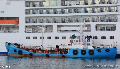
 Bawa 1
Current Status
Where is the vessel?
Bawa 1 is currently in Near Floriana, based on AIS data received about 2h ago.
Latest AIS update:
Current position: 35.88164° N, 14.50127° E (Near Floriana)
Average speed (last 7 days): Loading…
Average speed (last 30 days): Loading…
Vessel profile: Bawa 1 is a Service Ship with dimensions 39m x 8m.
This page combines live AIS, route history, probable destination signals, nearby traffic, and port activity for practical vessel monitoring.
The current position of vessel Bawa 1 is 35.88164 lat / 14.50127 lng. Updated: 2026-05-13 17:23:34 UTCNearest reference points:
- Near Floriana
- Near Sliema
- Near Valletta
Currently sailing under the flag of Malta ![]()
Bawa 1 built in 1972 year
Deadweight:
421 tDetails:
Live Vessel Bawa 1 Analytics (details, animations, etc.)
Recent AIS points (UTC):
2026-05-13 14:20:36 UTC · 35.88167, 14.50125 · SOG 0 kn · COG -1°2026-05-13 15:35:37 UTC · 35.88168, 14.50127 · SOG 0 kn · COG -1°
2026-05-13 16:35:33 UTC · 35.88169, 14.50126 · SOG 0 kn · COG -1°
2026-05-13 17:23:34 UTC · 35.88164, 14.50127 · SOG 0 kn · COG -1°