 vesseltracker.com
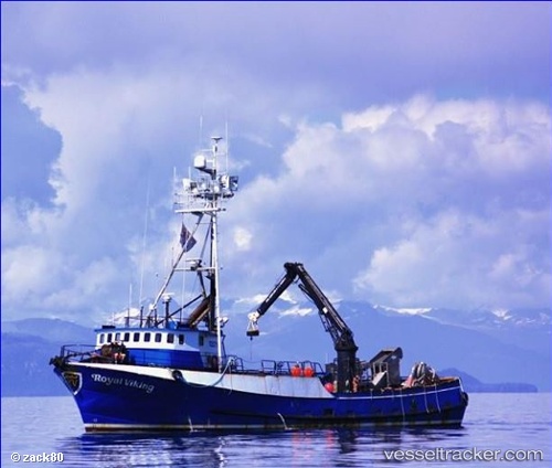
Royal Viking
Current StatusWhere is the vessel?
Royal Viking is currently in Near Dutch Harbor, based on AIS data received less than 1h ago.
Latest AIS update:
Current position: 53.86852° N, 166.55463° W (Near Dutch Harbor)
Average speed (last 7 days): Loading…
Average speed (last 30 days): Loading…
Vessel profile: Royal Viking is a Fishing Vessel with dimensions 7m x 32m.
This page combines live AIS, route history, probable destination signals, nearby traffic, and port activity for practical vessel monitoring.
The current position of vessel Royal Viking is 53.86852 lat / -166.55463 lng. Updated: 2026-05-14 19:38:27 UTCNearest reference points:
- Near Dutch Harbor
Details:
Live Vessel Royal Viking Analytics (details, animations, etc.)
Recent AIS points (UTC):
2026-05-14 16:25:08 UTC · 53.86859, -166.55469 · SOG 0 kn · COG -1°2026-05-14 18:00:28 UTC · 53.86854, -166.55460 · SOG 0 kn · COG -1°
2026-05-14 19:27:46 UTC · 53.86848, -166.55460 · SOG 0 kn · COG -1°
2026-05-14 19:38:27 UTC · 53.86852, -166.55463 · SOG 0 kn · COG -1°