 vesseltracker.com
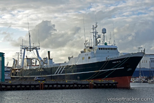
Blaengur
Current StatusWhere is the vessel?
Blaengur is currently in 65 nm W of PATREKSFJORDUR, based on AIS data received less than 1h ago.
Latest AIS update:
Current position: 65.92278° N, 26.53859° W (65 nm W of PATREKSFJORDUR)
Average speed (last 7 days): Loading…
Average speed (last 30 days): Loading…
Vessel profile: Blaengur is a Fishing Vessel with dimensions 12m x 79m.
This page combines live AIS, route history, probable destination signals, nearby traffic, and port activity for practical vessel monitoring.
The current position of vessel Blaengur is 65.92278 lat / -26.53859 lng. Updated: 2026-05-15 12:22:27 UTCNearest reference points:
- 82 nm W of Hafnir
Details:
Live Vessel Blaengur Analytics (details, animations, etc.)
Recent AIS points (UTC):
2026-05-15 07:52:00 UTC · 65.57403, -25.80889 · SOG 3.3 kn · COG 118°2026-05-15 10:21:57 UTC · 65.59592, -25.90543 · SOG 14.1 kn · COG 300°
2026-05-15 10:36:26 UTC · 65.63284, -26.00652 · SOG 14.2 kn · COG 322°
2026-05-15 12:22:27 UTC · 65.92278, -26.53859 · SOG 5.8 kn · COG 325°