 vesseltracker.com
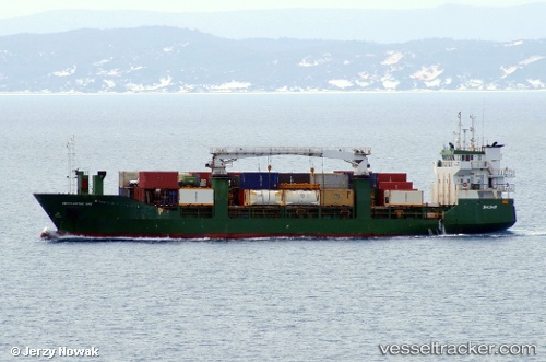
 ISLA TAUTIL
Current Status
Where is the vessel?
ISLA TAUTIL is currently in 13 nm SE of Quinchao, based on AIS data received less than 1h ago.
Latest AIS update:
Current position: 42.67805° S, 73.19853° W (13 nm SE of Quinchao)
Average speed (last 7 days): Loading…
Average speed (last 30 days): Loading…
Vessel profile: ISLA TAUTIL is a General Cargo Ship with dimensions 13m x 83m.
This page combines live AIS, route history, probable destination signals, nearby traffic, and port activity for practical vessel monitoring.
The current position of vessel ISLA TAUTIL is -42.67805 lat / -73.19853 lng. Updated: 2026-04-28 09:21:20 UTCNearest reference points:
- Near Chonchi
- Near Quellón (Puerto Quellón)
- Near Puerto Montt
Currently sailing under the flag of Chile ![]()
ISLA TAUTIL built in 1991 year
Deadweight:
2750 tDetails:
Live Vessel ISLA TAUTIL Analytics (details, animations, etc.)
Recent AIS points (UTC):
2026-04-28 05:31:23 UTC · -42.01265, -72.98176 · SOG 10.7 kn · COG 178°2026-04-28 07:26:20 UTC · -42.35966, -73.02906 · SOG 10.8 kn · COG 199°
2026-04-28 07:54:56 UTC · -42.43996, -73.07171 · SOG 10.6 kn · COG 203°
2026-04-28 09:21:20 UTC · -42.67805, -73.19853 · SOG 11.4 kn · COG 198°