 vesseltracker.com
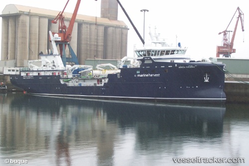
 RONIA POLARIS
Current Status
Where is the vessel?
RONIA POLARIS is currently in 30 nm SE of Melinka, based on AIS data received less than 1h ago.
Latest AIS update:
Current position: 44.30636° S, 73.43595° W (30 nm SE of Melinka)
Average speed (last 7 days): Loading…
Average speed (last 30 days): Loading…
Vessel profile: RONIA POLARIS is a Fish Carrier with dimensions m x m.
This page combines live AIS, route history, probable destination signals, nearby traffic, and port activity for practical vessel monitoring.
The current position of vessel RONIA POLARIS is -44.30636 lat / -73.43595 lng. Updated: 2026-05-14 00:19:01 UTCNearest reference points:
- Near Melinka
- Near Quellón (Puerto Quellón)
- Near Chonchi
Details:
Live Vessel RONIA POLARIS Analytics (details, animations, etc.)
Recent AIS points (UTC):
2026-05-13 19:46:35 UTC · -45.11737, -73.48143 · SOG 9.9 kn · COG 9°2026-05-13 21:32:15 UTC · -44.80833, -73.48333 · SOG 10 kn · COG -1°
2026-05-13 22:59:57 UTC · -44.54023, -73.47839 · SOG 11.1 kn · COG 10°
2026-05-14 00:19:01 UTC · -44.30636, -73.43595 · SOG 10 kn · COG 10°