 vesseltracker.com
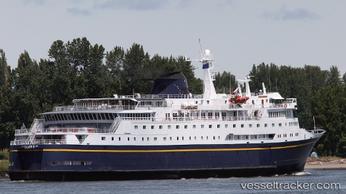
Columbia
Current StatusWhere is the vessel?
Columbia is currently in Near Ketchikan, based on AIS data received about 112d ago.
Latest AIS update:
Current position: 55.35532° N, 131.69952° W (Near Ketchikan)
Average speed (last 7 days): Loading…
Average speed (last 30 days): Loading…
Vessel profile: Columbia is a Passenger Ro Ro Cargo Ship with dimensions 26m x 127m.
This page combines live AIS, route history, probable destination signals, nearby traffic, and port activity for practical vessel monitoring.
The current position of vessel Columbia is 55.35532 lat / -131.69952 lng. Updated: 2026-01-21 10:20:17 UTCNearest reference points:
- Near Ward Cove
- Near Wrangell
- 15 nm N of Port Clements
Details:
Live Vessel Columbia Analytics (details, animations, etc.)
Recent AIS points (UTC):
2026-01-21 10:20:17 UTC · 55.35532, -131.69952 · SOG 0 kn · COG 130°