 vesseltracker.com
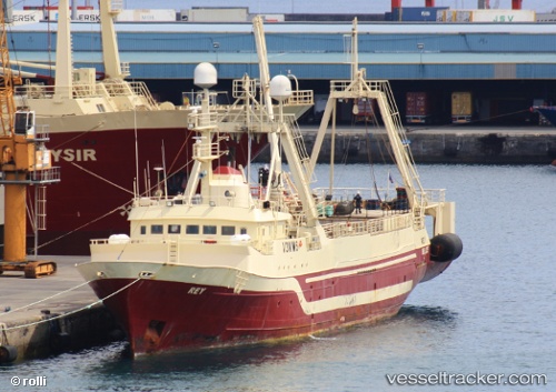
Rey
Current StatusWhere is the vessel?
Rey is currently in Near Port de Boké, based on AIS data received about 1h ago.
Latest AIS update:
Current position: 10.37811° N, 14.79542° W (Near Port de Boké)
Average speed (last 7 days): Loading…
Average speed (last 30 days): Loading…
Vessel profile: Rey is a Fish Factory Ship with dimensions 13m x 72m.
This page combines live AIS, route history, probable destination signals, nearby traffic, and port activity for practical vessel monitoring.
The current position of vessel Rey is 10.37811 lat / -14.79542 lng. Updated: 2026-04-28 19:54:04 UTCNearest reference points:
- Near Port de Boké
- 14 nm S of Port de Boké
- Near Dougoula
Details:
Live Vessel Rey Analytics (details, animations, etc.)
Recent AIS points (UTC):
2026-04-28 15:33:51 UTC · 10.38786, -14.78689 · SOG 1.2 kn · COG -1°2026-04-28 16:40:57 UTC · 10.38667, -14.78333 · SOG 0 kn · COG -1°
2026-04-28 18:05:30 UTC · 10.36852, -14.76883 · SOG 0.5 kn · COG -1°
2026-04-28 19:54:04 UTC · 10.37811, -14.79542 · SOG 7 kn · COG -1°