 vesseltracker.com
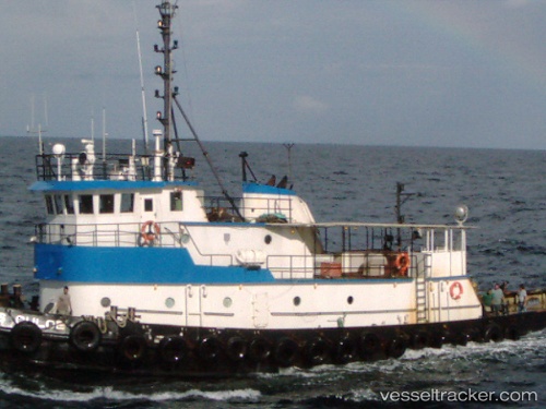
 MISS CHLOE
Current Status
Where is the vessel?
MISS CHLOE is currently in Near Caucedo, based on AIS data received about 349d ago.
Latest AIS update:
Current position: 18.44014° N, 69.63096° W (Near Caucedo)
Average speed (last 7 days): Loading…
Average speed (last 30 days): Loading…
Vessel profile: MISS CHLOE is a Tug with dimensions 9m x 40m.
This page combines live AIS, route history, probable destination signals, nearby traffic, and port activity for practical vessel monitoring.
The current position of vessel MISS CHLOE is 18.44014 lat / -69.63096 lng. Updated: 2025-05-14 18:28:35 UTCNearest reference points:
- Near CASA DE CAMPO
- Near Bahia De Las Calderas
- 32 nm N of Punta Cana Apt
Currently sailing under the flag of Colombia ![]()
MISS CHLOE built in 1971 year
Deadweight:
0 tDetails:
Live Vessel MISS CHLOE Analytics (details, animations, etc.)
Recent AIS points (UTC):
2025-05-14 18:28:35 UTC · 18.44014, -69.63096 · SOG 0.1 kn · COG -1°