 vesseltracker.com
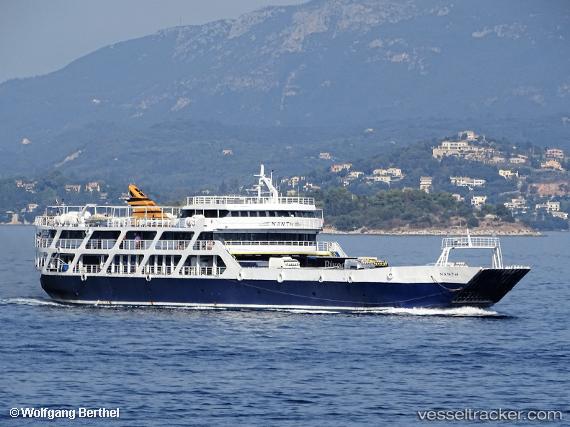
Nanti
Current StatusWhere is the vessel?
Nanti is currently in Near Igoumenítsa, based on AIS data received about 7h ago.
Latest AIS update:
Current position: 39.49878° N, 20.26295° E (Near Igoumenítsa)
Average speed (last 7 days): Loading…
Average speed (last 30 days): Loading…
Vessel profile: Nanti is a Passenger Ro Ro Cargo Ship with dimensions 16m x 78m.
This page combines live AIS, route history, probable destination signals, nearby traffic, and port activity for practical vessel monitoring.
The current position of vessel Nanti is 39.49878 lat / 20.26295 lng. Updated: 2026-05-13 14:58:32 UTCNearest reference points:
- Near Lefkímmi
- Near Paxi
- Near Corfu
Details:
Live Vessel Nanti Analytics (details, animations, etc.)
Recent AIS points (UTC):
2026-05-13 14:58:32 UTC · 39.49878, 20.26295 · SOG 0 kn · COG -1°2026-05-13 14:58:32 UTC · 39.49878, 20.26295 · SOG 0 kn · COG -1°
2026-05-13 14:58:32 UTC · 39.49878, 20.26295 · SOG 0 kn · COG -1°
2026-05-13 14:58:32 UTC · 39.49878, 20.26295 · SOG 0 kn · COG -1°