 vesseltracker.com
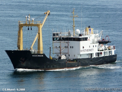
 VIKINGFJORD
Current Status
Where is the vessel?
VIKINGFJORD is currently in 38 nm NW of Ny-Ålesund, based on AIS data received about 1h ago.
Latest AIS update:
Current position: 79.51001° N, 10.59118° E (38 nm NW of Ny-Ålesund)
Average speed (last 7 days): Loading…
Average speed (last 30 days): Loading…
Vessel profile: VIKINGFJORD is a Buoy-laying Vessel with dimensions m x m.
This page combines live AIS, route history, probable destination signals, nearby traffic, and port activity for practical vessel monitoring.
The current position of vessel VIKINGFJORD is 79.51001 lat / 10.59118 lng. Updated: 2026-05-14 17:23:49 UTCCurrently sailing under the flag of Dominica ![]()
Details:
Live Vessel VIKINGFJORD Analytics (details, animations, etc.)
Recent AIS points (UTC):
2026-05-14 13:55:10 UTC · 79.80290, 11.91226 · SOG 0.9 kn · COG 188°2026-05-14 16:11:49 UTC · 79.67061, 11.13491 · SOG 10.7 kn · COG 177°
2026-05-14 16:14:48 UTC · 79.66283, 11.12624 · SOG 8.6 kn · COG 202°
2026-05-14 17:23:49 UTC · 79.51001, 10.59118 · SOG 10.3 kn · COG 174°