 vesseltracker.com
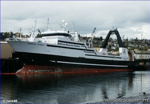
American Dynasty
Current StatusWhere is the vessel?
American Dynasty is currently in Near Interbay, based on AIS data received less than 1h ago.
Latest AIS update:
Current position: 47.62856° N, 122.37942° W (Near Interbay)
Average speed (last 7 days): Loading…
Average speed (last 30 days): Loading…
Vessel profile: American Dynasty is a Fishing Vessel with dimensions 16m x 90m.
This page combines live AIS, route history, probable destination signals, nearby traffic, and port activity for practical vessel monitoring.
The current position of vessel American Dynasty is 47.62856 lat / -122.37942 lng. Updated: 2026-05-17 17:53:19 UTCNearest reference points:
- Near Interbay
- Near Ballard/Seattle
- Near SHILSHOLE
Details:
Live Vessel American Dynasty Analytics (details, animations, etc.)
Recent AIS points (UTC):
2026-05-17 13:49:49 UTC · 47.62851, -122.37944 · SOG 0 kn · COG 180°2026-05-17 15:29:08 UTC · 47.62856, -122.37945 · SOG 0 kn · COG 180°
2026-05-17 17:01:58 UTC · 47.62855, -122.37942 · SOG 0 kn · COG 180°
2026-05-17 17:53:19 UTC · 47.62856, -122.37942 · SOG 0 kn · COG 179°