 vesseltracker.com
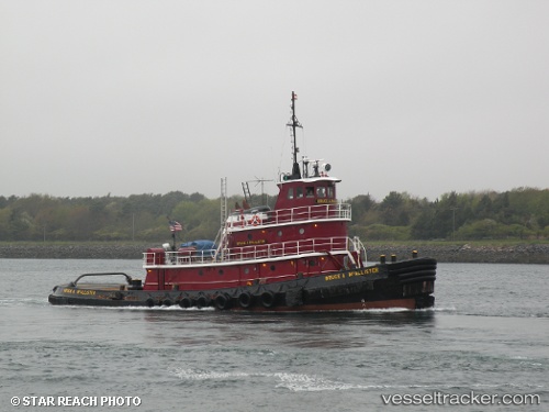
 BRUCE A. MCALLISTER
Current Status
Where is the vessel?
BRUCE A. MCALLISTER is currently in Near Port Ivory/Staten Isl/New York, based on AIS data received less than 1h ago.
Latest AIS update:
Current position: 40.64115° N, 74.16396° W (Near Port Ivory/Staten Isl/New York)
Average speed (last 7 days): Loading…
Average speed (last 30 days): Loading…
Vessel profile: BRUCE A. MCALLISTER is a Tug with dimensions m x m.
This page combines live AIS, route history, probable destination signals, nearby traffic, and port activity for practical vessel monitoring.
The current position of vessel BRUCE A. MCALLISTER is 40.64115 lat / -74.16396 lng. Updated: 2026-04-28 19:37:56 UTCNearest reference points:
- Near Port Ivory/Staten Isl/New York
- Near Elizabethport
- Near Maher Terminal
Currently sailing under the flag of United States of America ![]()
BRUCE A. MCALLISTER built in 1974 year
Deadweight:
0 tDetails:
Live Vessel BRUCE A. MCALLISTER Analytics (details, animations, etc.)
Recent AIS points (UTC):
2026-04-28 16:20:56 UTC · 40.67045, -74.06261 · SOG 2 kn · COG 356°2026-04-28 16:28:56 UTC · 40.67648, -74.06934 · SOG 2.7 kn · COG 318°
2026-04-28 17:25:49 UTC · 40.64060, -74.15788 · SOG 5.8 kn · COG 280°
2026-04-28 19:37:56 UTC · 40.64115, -74.16396 · SOG 0 kn · COG 103°