 vesseltracker.com
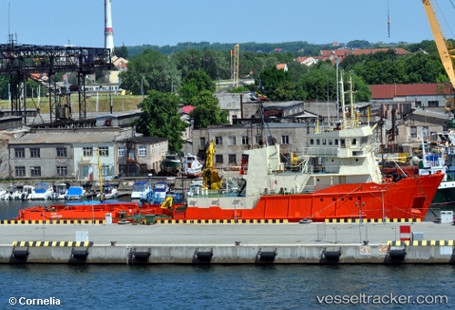
 Glomar Patriot
Current Status
Where is the vessel?
Glomar Patriot is currently in 52 nm SW of Claonaig, based on AIS data received about 2d ago.
Latest AIS update:
Current position: 54.94685° N, 4.79884° E (52 nm SW of Claonaig)
Average speed (last 7 days): Loading…
Average speed (last 30 days): Loading…
Vessel profile: Glomar Patriot is a Offshore Tug Supply Ship with dimensions 60m x 12m.
This page combines live AIS, route history, probable destination signals, nearby traffic, and port activity for practical vessel monitoring.
The current position of vessel Glomar Patriot is 54.94685 lat / 4.79884 lng. Updated: 2026-05-13 22:23:55 UTCNearest reference points:
- 14 nm NW of Town Quays/Drogheda
- Near Neeltje Jans
- Near Molengat
Currently sailing under the flag of Panama ![]()
Glomar Patriot built in 1975 year
Deadweight:
782 tDetails:
Live Vessel Glomar Patriot Analytics (details, animations, etc.)
Recent AIS points (UTC):
2026-05-13 22:23:55 UTC · 54.94685, 4.79884 · SOG 4.1 kn · COG 317°2026-05-13 22:23:55 UTC · 54.94685, 4.79884 · SOG 4.1 kn · COG 317°
2026-05-13 22:23:55 UTC · 54.94685, 4.79884 · SOG 4.1 kn · COG 317°
2026-05-13 22:23:55 UTC · 54.94685, 4.79884 · SOG 4.1 kn · COG 317°