 vesseltracker.com
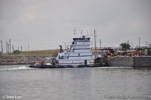
Atlas
Current StatusWhere is the vessel?
Atlas is currently in Near OCEAN MARINE, based on AIS data received about 59d ago.
Latest AIS update:
Current position: 29.65756° N, 91.02979° W (Near OCEAN MARINE)
Average speed (last 7 days): Loading…
Average speed (last 30 days): Loading…
Vessel profile: Atlas is a Offshore Tug Supply Ship with dimensions 12m x 38m.
This page combines live AIS, route history, probable destination signals, nearby traffic, and port activity for practical vessel monitoring.
The current position of vessel Atlas is 29.65756 lat / -91.02979 lng. Updated: 2026-03-17 19:27:05 UTCNearest reference points:
- Near Amelia
- Near HOUMA
- Near Port Of South Louisiana
Details:
Live Vessel Atlas Analytics (details, animations, etc.)
Recent AIS points (UTC):
2026-03-17 19:27:05 UTC · 29.65756, -91.02979 · SOG 0 kn · COG 50°