 vesseltracker.com
 RODNEY
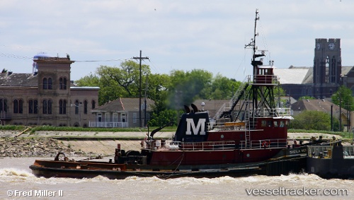
Current Status
Where is the vessel?
RODNEY is currently in Near New Orleans, based on AIS data received about 2h ago.
Latest AIS update:
Current position: 29.95635° N, 90.03519° W (Near New Orleans)
Average speed (last 7 days): Loading…
Average speed (last 30 days): Loading…
Vessel profile: RODNEY is a Tug with dimensions 37m x 11m.
This page combines live AIS, route history, probable destination signals, nearby traffic, and port activity for practical vessel monitoring.
The current position of vessel RODNEY is 29.95635 lat / -90.03519 lng. Updated: 2026-05-15 01:24:07 UTCNearest reference points:
- Near Marrero
- Near Meraux
- Near Boutte
Currently sailing under the flag of United States of America ![]()
RODNEY built in 1975 year
Deadweight:
0 tDetails:
Live Vessel RODNEY Analytics (details, animations, etc.)
Recent AIS points (UTC):
2026-05-14 22:03:14 UTC · 29.93187, -90.22007 · SOG 0 kn · COG 351°2026-05-14 22:06:17 UTC · 29.93183, -90.22002 · SOG 0 kn · COG 347°
2026-05-15 00:20:46 UTC · 29.93321, -90.17881 · SOG 12.8 kn · COG 45°
2026-05-15 01:24:07 UTC · 29.95635, -90.03519 · SOG 8.1 kn · COG 114°