 vesseltracker.com
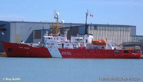
 Cape Roger
Current Status
Where is the vessel?
Cape Roger is currently in 29 nm E of Donkin, based on AIS data received less than 1h ago.
Latest AIS update:
Current position: 46.32667° N, 59.20667° W (29 nm E of Donkin)
Average speed (last 7 days): Loading…
Average speed (last 30 days): Loading…
Vessel profile: Cape Roger is a Fishing Support Vessel with dimensions m x m.
This page combines live AIS, route history, probable destination signals, nearby traffic, and port activity for practical vessel monitoring.
The current position of vessel Cape Roger is 46.32667 lat / -59.20667 lng. Updated: 2026-05-16 15:30:21 UTCNearest reference points:
- Near Goldboro
Currently sailing under the flag of Canada ![]()
Cape Roger built in 1977 year
Deadweight:
528 tDetails:
Live Vessel Cape Roger Analytics (details, animations, etc.)
Recent AIS points (UTC):
2026-05-16 11:35:16 UTC · 46.21902, -60.21469 · SOG 9.1 kn · COG 35°2026-05-16 13:18:06 UTC · 46.30061, -59.83382 · SOG 11.5 kn · COG 86°
2026-05-16 13:24:16 UTC · 46.30155, -59.80536 · SOG 11.5 kn · COG 87°
2026-05-16 15:30:21 UTC · 46.32667, -59.20667 · SOG 12 kn · COG -1°