 vesseltracker.com
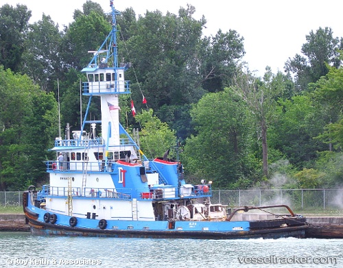
 Allie B
Current Status
Where is the vessel?
Allie B is currently in Near Sparrows Point, based on AIS data received less than 1h ago.
Latest AIS update:
Current position: 39.15307° N, 76.35326° W (Near Sparrows Point)
Average speed (last 7 days): Loading…
Average speed (last 30 days): Loading…
Vessel profile: Allie B is a Tug with dimensions 35m x 35m.
This page combines live AIS, route history, probable destination signals, nearby traffic, and port activity for practical vessel monitoring.
The current position of vessel Allie B is 39.15307 lat / -76.35326 lng. Updated: 2026-05-14 11:28:30 UTCNearest reference points:
- Near Orchard Beach
- Near Annapolis
- Near DUNDALK
Currently sailing under the flag of USA ![]()
Allie B built in 1977 year
Details:
Live Vessel Allie B Analytics (details, animations, etc.)
Recent AIS points (UTC):
2026-05-14 08:01:01 UTC · 39.15444, -76.35901 · SOG 0.3 kn · COG 190°2026-05-14 10:23:02 UTC · 39.15317, -76.35362 · SOG 0 kn · COG 111°
2026-05-14 10:32:30 UTC · 39.15319, -76.35363 · SOG 0 kn · COG 112°
2026-05-14 11:28:30 UTC · 39.15307, -76.35326 · SOG 0 kn · COG 110°